


Next: 1.6.5 The -K -O
Up: 1.6 GMT Common Command
Previous: 1.6.3 The -H option
Contents
Index
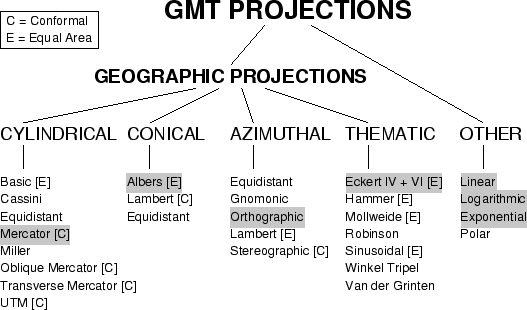
Figure 1.9:
The 25 projections available in GMT
 |
Selects the map projection. The following code (?) determines the
projection. Specify map width (or axis lengths) in the unit of
your choice. The projections avaiable in GMT are presented in Figure 1.9.
For this tutorial we will choose one of the following projections
(for details on all GMT projections see the psbasemap man page):
- Mercator:
- -JMwidth.
- Orthographic:
- -JG
 . The
. The
 specifies the projection center.
- Albers conic:
- -JB
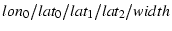 .
Give projection center and two standard parallels.
.
Give projection center and two standard parallels.
- Eckert IV and VI:
- -JK[f
 s]
s] . Give the central meridian.
- Linear:
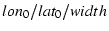
- -JX
 . Give width [and height]
of plot. width [and/or height] can be given in any of the
following 3 formats:
. Give width [and height]
of plot. width [and/or height] can be given in any of the
following 3 formats:
- -JXwidth[d]--Regular linear scaling. Append
'd' if x and y are geographical coordinates in degrees;
this allows for 360
 periodicity and degree-symbols in annotations.
- -JXwidthl--Take log
 of values before scaling.
- -JXwidthppower--Raise values to power
before scaling.
Use negative width [and height] to reverse the direction of
an axis (e.g., to have y be positive down).
Next: 1.6.5 The -K -O
Up: 1.6 GMT Common Command
Previous: 1.6.3 The -H option
Contents
Index
Paul Wessel
2001-04-18