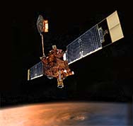
Mars Global Surveyor
 Mars Global Surveyor | MGS Data Tools |
This page is intended to be a starting point for Mars researchers that wish to utilize data from the Mars Global Surveyor. It contains links to the raw data, and also links to the various software tools that various members of the community have created to analyze the data itself.
- Mars Global Surveyor Data Archives
- Where do you get the MGS data? Get it from the Mars Global Surveyor Data Archives on the PDS Geosciences Node. Don't download images from MSSS or other team websites. You don't know what's been done to it. Data posted at the PDS is peer-reviewed raw data, and is the official science archive. Accept no substitutes!
The data being returned by this spacecraft is phenominal. Lots of data is good from a scientific point of view, but as more and more data comes in it becomes more and more difficult to manage and interpret. Various members of the scientific community have already written a fair amount of code to deal with this data. Those listed below are nice enough to share their work with the community.
Locating Data
Its often a daunting task just trying to find what MGS data is in the area that you are interested in. These tools may help.
- U.S.G.S. Planetary GIS Web Server - PIGWAD
- This is the beginning of a Global Information System for Mars. Its a great place to go to find out which MOC images or MOLA profiles are where. Once you find an image or profile that you're interested in, PIGWAD will tell you what its name is, and where to find it in the PDS archive. Even better, its totally web-based, so there's no program to download.
- LocMOC
- This IDL program is useful for exactly locating MOC footprints and MOLA ground tracks on the old Viking basemap. A version of its instruction manual is online. For those of you that have been to MSSS, this program is similar to BROWSE.
- Mars Landing Sites
- This page is a resource for data in the equatorial regions on Mars, and contains information for data near proposed landing sites and 3D VRML information (see the site for details).
MOC Data analysis
You've found the raw images that you wanted from the PDS archive, and now you're ready to do some science.
- XV plus
- If you just want to take a look at the raw PDS data, I suggest using the PIRL XV Plus, which is the old XV that you know and love, modified to display all kinds of image formats, including the PDS
.imgformat that the raw MOC data are in.
- ISIS
- ISIS is a program available for a variety of platforms, and it is the program that should be used to clean the raw images. Its useful for a variety of planetary spacecraft data, but also has specific routines written for the kinds of image noise in the MOC images.
MOLA Data analysis
You've gotten the MOLA binaries that cross your region of interest, or you've found a gridded data set that suits your purposes, how do you read it?
- PDS MOLA Software Archive
- The MOLA team has provided a number of routines to split up the large binary files, convert the binaries to an ASCII format, and to plot the profiles.
- Jim Roark?
- Jim Roark has written a number of nifty routines, but is still working on getting them put up on the web.
If you have any comments or questions, just let me know. Similarly, if you have come up with a new data tool that you think would be useful to the Mars Scientific community, please let me know, and I can add a link to it.
Last Modified: 30 March 2000