Titan RADAR SAR Swaths
Ta | T3 | T7 | T8 | T13 | T15 | T16 | T17 | T18 | T19 | T20 | T21 | T23 | T25 | T28 | T29 | T30 | T36 | T39 | T41 | T43 | T44
T48 | T49 | T50 | T55 | T56 | T57 | T58 | T59 | T61 | T64 | T65 | T71 | T77 | T83 | T84
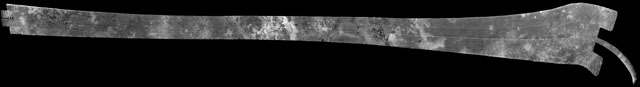
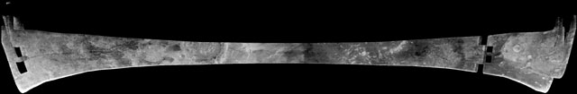
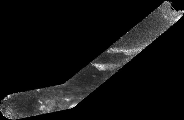
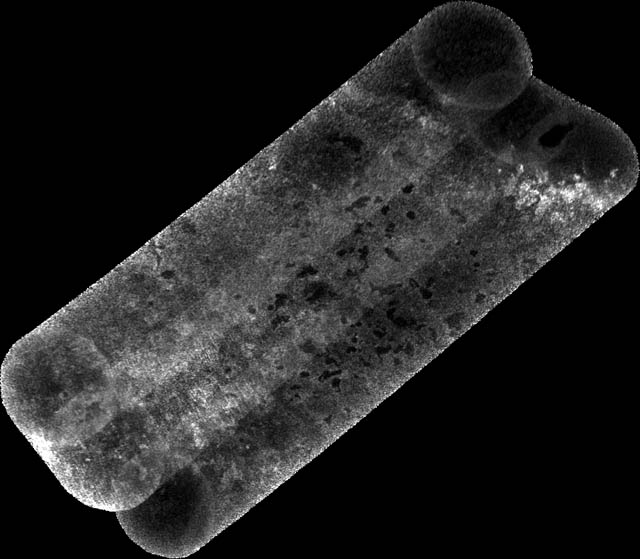
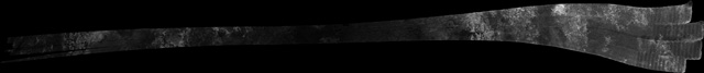
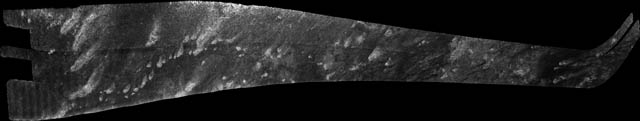
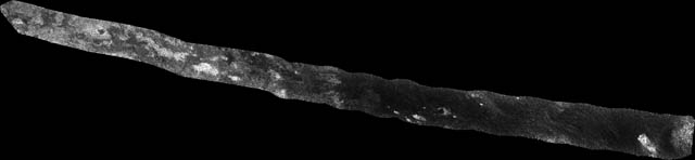
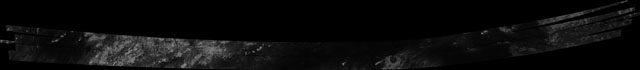
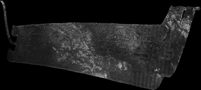
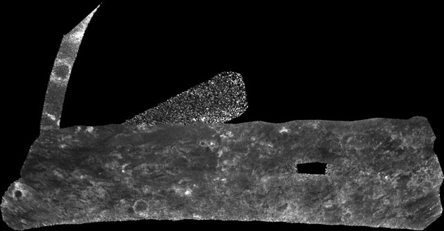
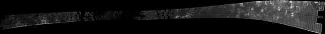
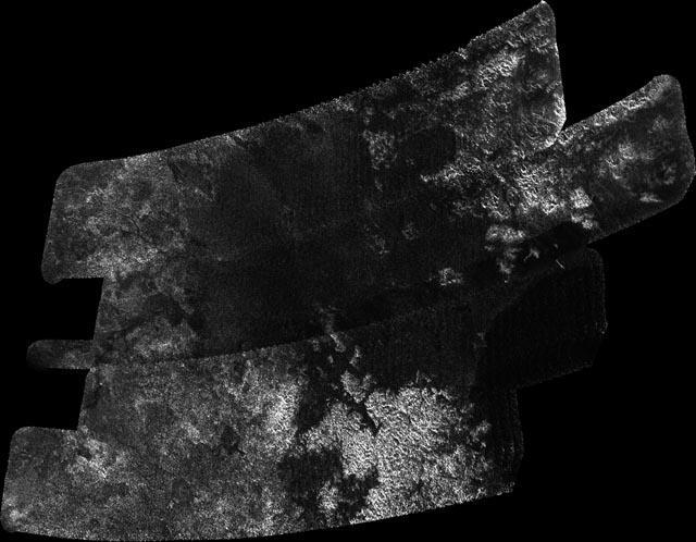
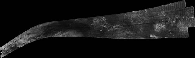
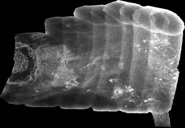
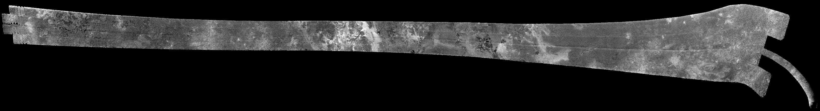
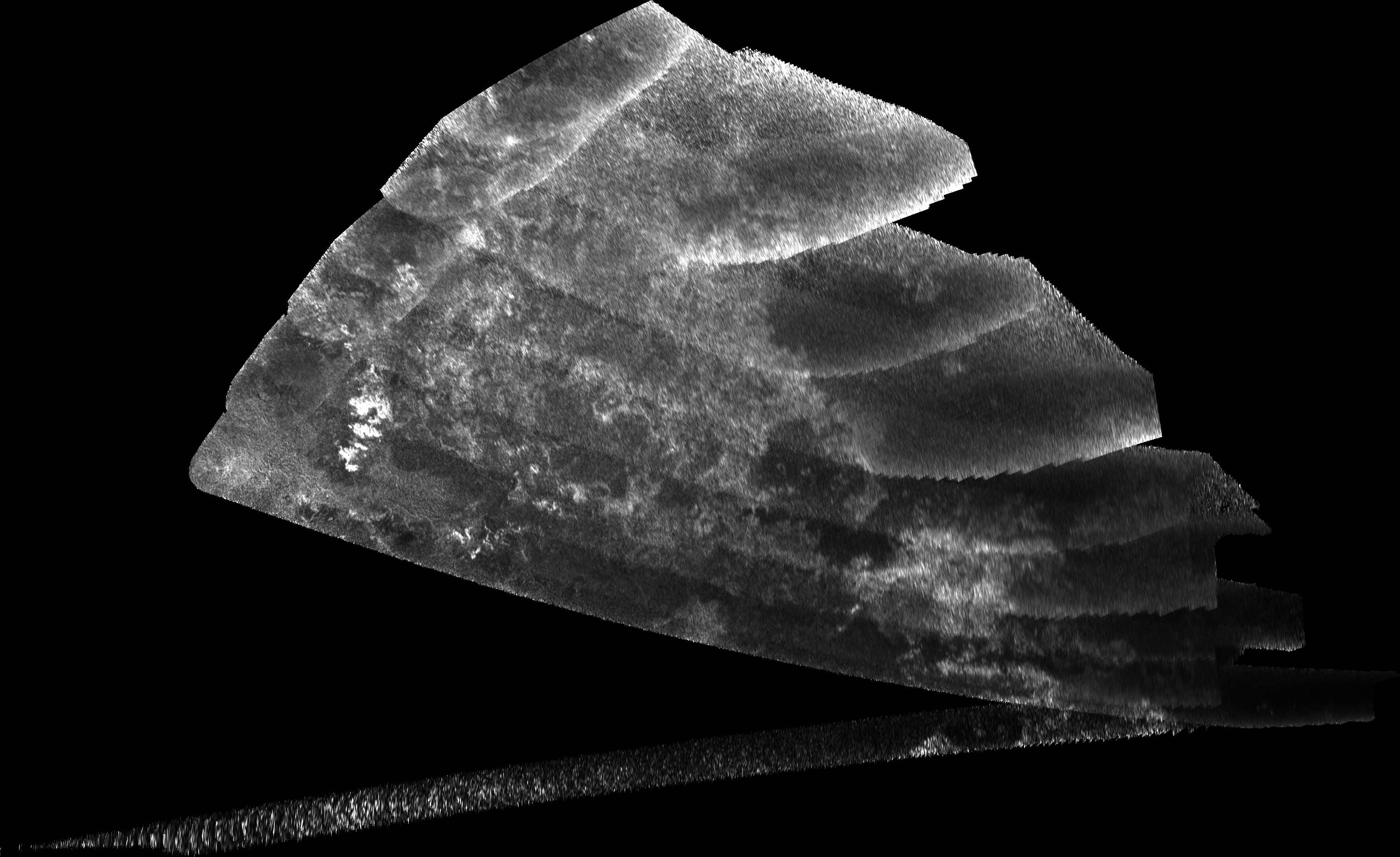
Posted below are 52 RADAR swaths currently available on the NASA Planetary Image Atlas website. These swaths are available in a scientifically useful format, but one which is not accessable to most of the public. The following files are jpegs converted from the original files on the PDS website. Each swath is available in three size formats: 32 pixels per degree (1.4 km/pixel), 128 pixels per degree (0.351 km/pixel), and 256 pixels per degree (0.1755 km/pixel). Due to the limitation of Photoshop, which is used to convert tif versions of these swaths to JPEG, some of the full-sized swaths are split into two files.
These swaths are posted here for the convenience of the general public, and are not in a scientifically useful format. Planetary scientists, please use the versions posted on the PDS for analysis. These swaths were planned and processed (except for the conversion to JPEG format) by the Cassini RADAR team, and acknowledgement of this great data set goes to them.
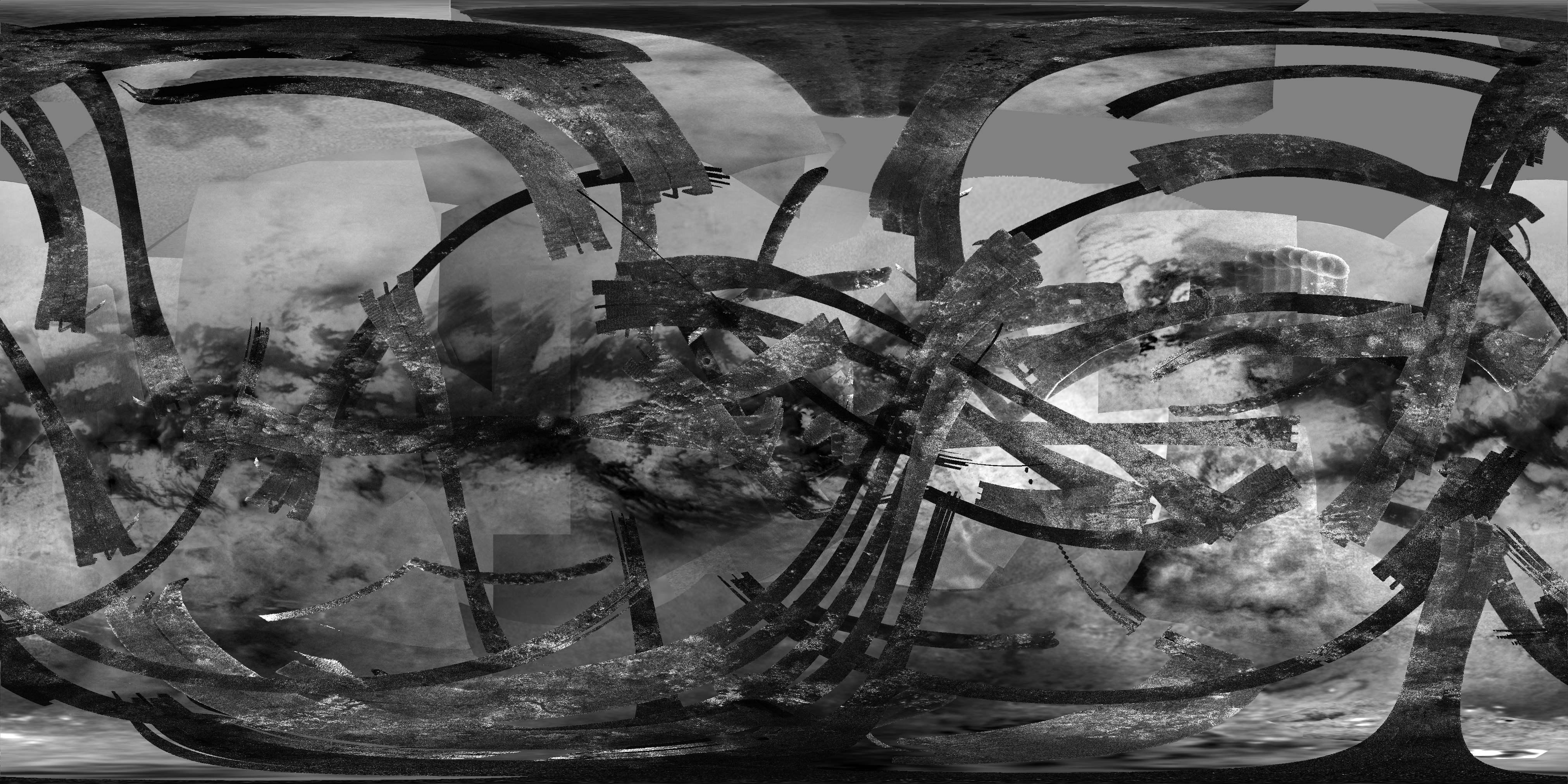
Here is a map combining the RADAR swaths released so far and the latest ISS near-infrared albedo map:

North Polar Map with grid lines (128 pixels/deg.) [through T83]
South Polar Map with grid lines (128 pixels/deg.) [through T65]
Large Simple Cylindrical Map (SAR swaths only, no grid lines) (32 pixels/deg.) [through T71]
Large Simple Cylindrical Map (SAR with ISS basemap background, no grid lines) (32 pixels/deg.) [through T71]
Ta (October 26, 2004) - Northern mid-latitudes (Ganesa Macula, cryovolcanism)
T3 (February 15, 2005) - Northern mid-latitudes (Northern Xanadu, Menrva, Omacatl Macula, Northeastern Fensal, Sinlap)
T7 (September 7, 2005) - Southern Mid-latitudes (Central Tsegihi, Mezzoramia)

T8 (October 28, 2005) - Equatorial Pass (Trailing hemisphere, Central Adiri, Central Belet, Huygens Landing Site, Antillia Faculae)

T13 (April 30, 2006) - Equatorial Pass (Leading hemisphere, Central Xanadu, Eastern Shangri-la, Guabonito, Shikoku Facula)

T13 (April 30, 2006) - Targeted Distant Look (Huygens Landing site)
T15 (July 2, 2006) - Targeted Distant Look (Tsegihi, Shiwanni Virgae)

T16 (July 22, 2006) - North Polar Pass (Northern Lakes Region, Northern Aaru)

T17 (September 7, 2006) - Short, ride-along pass (Western and central Fensal, Ksa crater)

T18 (September 22, 2006) - Short, ride-along pass (High Northern latitudes, Northern lakes region)

T19 (October 9, 2006) - North Polar Pass (Northern Lakes Region, Aaru)

T20 (October 25, 2006) - Targeted Distant Look (NW Xanadu, Tortola Facula)

T21 (December 12, 2006) - Short, ride-along pass (Belet)

T23 (January 13, 2007) - Northern mid-latitudes to equator (Ganesa Macula, Aaru, western Senkyo, Tsegihi)

T25 (February 22, 2007) - Northern Polar Region (Northern Lakes district, Northern Seas, Shiwanni Virgae, Fensal, Aztlan, Western Quivira)

T25 (February 22, 2007) - Targeted Distant Look (Northern Lake District)
T28 (April 10, 2007) - North Polar Region (Northern Lakes district, Northern Kraken Mare, Ligeia Mare, Fensal, Aztlan, Western Quivira)

T29 (April 26, 2007) - North Polar Region (Fensal, Northern Lakes District, Bolsena Lacus, North Pole Sea, Ligeia Mare)

T30 (May 12, 2007) - Central Kraken Mare and Points East

T36 (October 2, 2007) - Mid-Southern Latitudes

T39 (December 20, 2007) - South Polar Region, Western Mezzoramia
T41 (February 22, 2008) - Hotei Arcus, mid-latitude terrain south of Xanadu

T41 (February 22, 2008) - Antilia Faculae, Huygens landing site, mountain chains north of Adiri
T41 (February 22, 2008) - Targeted Distant Look (western Fensal, eastern Xanadu)
T43 (May 12, 2008) - Equatorial Anti-Saturnian hemisphere (Dilmun, Northern Shangri-la, Tortola Facula, Central Xanadu)

T43 (May 12, 2008) - Targeted Distant look (Western Tui Regio)
- Not processed at the moment
T44 (May 28, 2008) - Equatorial Anti-Saturnian hemisphere (Southern/Southwestern Xanadu, Eir Macula, Eastern Tui Regio, North-central Shangri-la, Southern Dilmun)

T48 (December 5, 2008) - South-western Xanadu and Tui Regio

T48 (December 5, 2008) - Equatorial Anti-Saturnian hemisphere (Southern half of Guabonito, northern Shikoku Facula, and parts of Shangri-la and Dilmun)
T48 (December 5, 2008) - Hi-SAR over mid-southern latitudes in the anti-Saturnian hemisphere

T49 (December 21, 2008) - High-Southern Latitudes in the Leading Hemisphere (Arrakis Planitia)
T49 (December 21, 2008) - North-South Swath across the equatorial Trailing hemisphere (Western Belet; north to the left in the supplied images)

T49 (December 21, 2008) - Hi-SAR over trailing hemisphere (parallel to T21 swath)

T50 (February 7, 2009) - Trailing hemisphere (Near-IR bright streaks, Belet/Senkyo boundary

T55 (May 21, 2009) - North-South Swath across the equatorial anti-Saturn hemisphere (Eastern Shangri-la; mid-southern latitudes; Hobal Virga)

T55 (May 21, 2009) - Hi-SAR over small lake near Ontario Lacus

T56 (June 6, 2009) - North-South Swath across the anti-Saturn hemisphere (Eastern Shangri-la; Pair of unnamed craters, Santorini, Kerguelen Facula)

T56 (June 6, 2009) - Hi-SAR over northern Xanadu
T57 (June 22, 2009) - North-South Swath across the southern anti-Saturn hemisphere (Northern Ontario Lacus, Perkunas Virgae)

T58 (July 8, 2009) - North-South Swath across the southern anti-Saturn hemisphere (Ontario Lacus, Shangri-la/Xanadu Boundary, South Polar dry lakes)

T59 (July 24, 2009) - Southern High Latitudes on Titan's Anti-Saturn hemisphere

T61 (August 25, 2009) - East-West swath across central Belet, Adiri, and southern Dilmun

T64 (December 28, 2009) - Northern High-Latitudes (Punga Mare and Ligeia Mare)
T65 (January 12, 2010) - High southern latitudes (Ontario Lacus, Mezzoramia)

T65 (January 12, 2010) - HiSAR over a portion of Ontario Lacus
T71 (July 7, 2010) - Southern mid-latitudes (trailing hemisphere, Northern Mezzoramia

T77 (June 20, 2011) - Northwestern Fensal (Ksa and Momoy craters)
T77 (June 20, 2011) - Northwestern Fensal (Ksa and Menrva craters)
T83 (May 22, 2012) - North Polar lake district

T84 (June 7, 2012) - Northern Mid-latitudes on the trailing hemisphere

T84 (June 7, 2012) - HiSAR over Western Kraken Mare

![North Polar Map with grid lines (128 pixels/deg.) [through T83]](NPoleMap_128ppd_grid.jpg)
![South Polar Map with grid lines (128 pixels/deg.) [through T65]](SPoleMap_128ppd_grid.jpg)
![Large Simple Cylindrical Map (SAR swaths only, no grid lines) (32 pixels/deg.) [through T71]](Titan_SAR_32ppd_edited.png)
![Large Simple Cylindrical Map (SAR with ISS basemap background, no grid lines) (32 pixels/deg.) [through T71]](Titan_SARISS_32ppd_edited.png)