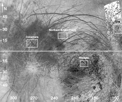
Figure 3. Mercator map of Europa between 140 - 320 W and 60 S - 60 N. The white boxes represent the regions that have been by Galileo at high resolution and mapped for strike-slip faults.